Everyday Spatial Practices in an Urban Village in Hefei
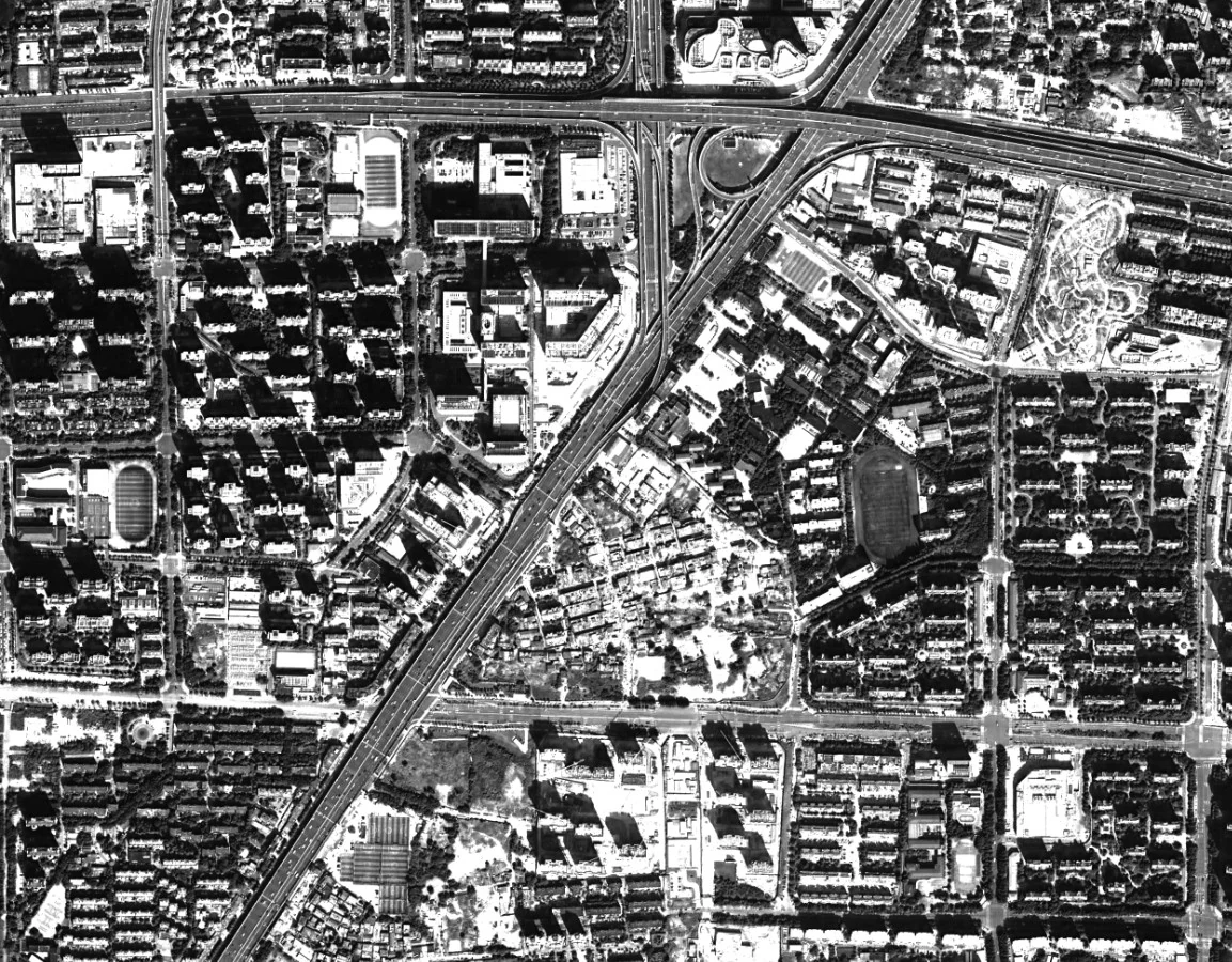
A socio-spatial investigation of Yaogongmiao, reading informal housing, street commerce, and shared spaces as a spatial logic shaped by everyday life.
- Site: Yaogongmiao, Hefei, Anhui, China
- Study: Architectural and anthropological investigation, 2017
- Scale: Urban context → public nodes → storefronts → dwellings
- Cover: Google Earth, 2024; not a 2017 fieldwork image
Reading an urban village through everyday life
Urban villages are often described through inadequate infrastructure, overcrowding, and redevelopment pressure. Yet they also sustain affordable housing, local commerce, and forms of social life that are difficult to read from a conventional land-use plan.
This 2017 investigation approached Yaogongmiao as a lived environment, rather than only a redevelopment problem. Combining architectural and anthropological approaches, it examined how residents, small businesses, and the built environment continually adapt to one another—from the wider city to a shop threshold or shared residential corridor.
The central question was how apparently fragmented spaces support a recognizable everyday order. The resulting maps and typological drawings make that order visible; they document existing conditions rather than propose a new masterplan.
Yaogongmiao carries traces of Hefei’s former outskirts within a rapidly transformed urban fabric. The warmth of everyday activity—yanhuoqi—is part of this setting, alongside the economic and spatial pressures around it.
Image chronology: the cover is a 2024 Google Earth view supplied with the project boards. The investigation and the contextual maps below refer to 2017; the later aerial image is not evidence of the site’s condition during fieldwork.
From rural settlement to urban enclave
The historical account traces a rural settlement through collective village organization and into an urbanized community. The Yaogong Village Committee was established in 1961, overseeing thirteen natural villages and fifteen villager groups. Agriculture and collective enterprises anchored its earlier identity.
Residential blocks and modern infrastructure gradually changed this context. Large-scale demolition and redevelopment began in 2012; pockets of the earlier fabric remained when the study was conducted in 2017.
The formation logic connects four conditions. These are not isolated problems, but a way to understand how informal settlement and adaptation develop together.
1. Land tenure
Collective ownership and the absence of formal title create a distinctive institutional setting.
2. Migration pull
Affordable rents and proximity to industry attract residents whose livelihoods depend on access to the city.
3. Self-organisation
Incremental construction and informal economic activity adapt spaces to changing needs.
4. Urban policy gap
Ambiguous status and redevelopment pressure sit alongside the continued use of the village.
From field observation to spatial analysis
The study moved through literature review → field observation → interviews → questionnaires → spatial mapping → typological analysis. Reading the site through several methods connected social questions with measurable spatial arrangements.
Literature research brought together social context and cultural identity, site morphology, livelihood and economic transformation, and urban governance. On site, three representative settings at different spatial scales were selected for closer observation. User shadowing added a day-in-the-life perspective on a key stakeholder’s experience.
Representative spaces were measured and documented through plans and axonometric drawings. The analytical sequence moves from where activities occur, to how shared spaces work, to how individual businesses and homes are arranged.
The surrounding city and its everyday edges
The 2017 infrastructure maps place the village among commercial areas, housing, industry, services, and residual land. The black triangle marks Yaogongmiao in each map. Viewed together, the layers establish the surrounding conditions within which residents find housing, work, and everyday services.
The maps locate the village; photographs bring the reading back to the ground. Narrow alleys, improvised structures, steps, and demolition remnants show a built environment being occupied and adjusted at close range.
Mapping overlap, not separate zones
The functional plans use a common site outline to compare main-street frontage, entertainment, catering, and living. Their value lies in the relationship between the layers: commercial activity penetrates the residential fabric rather than forming a completely separate district.
Overlap and hybridity are the key findings: ground-level spaces accommodate several uses, while thresholds and residual areas are reconfigured in response to demand. A land-use label alone cannot describe how these spaces operate.
The five-node study takes that observation further, examining how small public spaces mediate between housing, activity, and everyday logistics.
Five ways shared space takes shape
The nodes are readings of existing spatial conditions, not five new architectural proposals. Together, they show how shared life depends on courtyards, corners, passages, terrain, and service spaces—not only on formally designated public facilities.
1. Courtyard aggregation
Three building volumes enclose an L-shaped shared ground. Living, activity, and logistics meet around an inward-facing space that works as both a gathering place and a circulation hub.
2. Corner release
Two residential masses meet at an oblique angle, leaving a triangular public pocket. Rather than disappearing as leftover space, the corner becomes an outward-facing gathering point at the street edge.
3. Linear corridor
An elevated passage combines movement with a place to pause. Its position between residential volumes turns circulation into an activity deck and a social connection.
4. Diagonal terrace
Buildings step along the terrain, opening a broad communal plane. The slope gives the shared space a naturally terraced character without a formally designed theatre.
5. Edge service
A narrow interstitial space accommodates waste disposal and logistics beside housing. It is the less visible but essential counterpart to the more social nodes.
Across these examples, circulation and gathering are closely connected. The edge service node also matters: supporting shared life requires the spaces for waste and logistics as well as those for social activity.
Six storefront studies: commerce meets the street
The commercial strip serves students, families, older residents, and workers through a range of small, self-organized businesses. The six studies below compare the arrangement of operational space, customer space, and the street interface.
Each drawing pairs a plan with an exploded axonometric. Read together, they reveal recurring strategies—display spilling towards the sidewalk, preparation facing the street, outdoor dining, and commerce layered beneath other activities—without reducing the six cases to a single shop type.
A · Fruit retail
An operational area is reserved at the rear. Shelving and exterior display tables bring fruit selection towards the sidewalk.
B · Student dining
Dense indoor seating serves students, while a street-facing preparation zone connects the vendor directly with passersby. Service extends beyond the enclosed shop.
C · Two-level hybrid
Washing and preparation form the rear operational core at ground level. Dining occupies the front; flexible upper-floor rooms support small gatherings and social events.
D · Canopy and outdoor seating
Four-person tables occupy the interior. Preparation beneath a canopy and seating outside extend the working footprint towards the street.
E · Grill and outdoor dining
Rear storage supports indoor dining and an open-air grill. Preparation, eating, and storage are distributed across the interior and the street edge.
F · Garment retail
The interior is divided between browsing and display at the front and inventory at the rear, revealing a different balance of public interface and operational space.
The storefront is more than a facade. It is a negotiated boundary between a livelihood, a customer, and public space. The drawings document this existing spatial intelligence rather than impose a new retail model.
Living patterns and different claims to space
The study distinguishes four resident groups to situate the housing analysis. Their relationships to the village differ in duration, livelihood, tenure, and access to shared facilities.
| Resident group | Relationship to space |
|---|---|
| Migrant workers | Manufacturing and construction work; temporary tenancies and shared rooms. |
| Shop owners | Ground-floor commercial tenancy, domestic space above, and longer-term residence. |
| Local villagers | Original inhabitants, rental income, spatial memory, and ownership claims. |
| Students and young migrants | Proximity to colleges and factories, more transient residence, and shared facilities. |
The three exploded dwelling studies reveal how rooms, stairs, and domestic activities are distributed across floors. Dashed lines keep the levels spatially aligned so the building can be read as a layered arrangement rather than a single plan.
The original material does not assign these three dwelling types to particular resident groups. They are therefore presented as comparative spatial studies, not as a one-to-one classification of people and buildings.
A spatial logic produced from within
What can appear disordered from outside becomes more legible when read through the people, activities, and adaptations that sustain it. Housing, commerce, circulation, and shared space do not simply sit beside one another: they continually reshape one another.
The urban village is not only a dense settlement morphology. It is a socio-spatial system shaped through everyday practices, informal economies, and adaptive uses of space.
The contribution of this investigation is a way of seeing: moving between the urban context and small spatial arrangements reveals relationships that a redevelopment-only perspective can overlook.
Project context and image credits
Socio-spatial investigation, Yaogongmiao, Hefei, China, 2017. Adapted from the original three project boards. Cover: Google Earth, 2024. Historical imagery, field photographs, maps, and drawings are reproduced from the project materials; individual image credits are not fully specified in the original boards. Dates and maps describe the historical investigation, not a current survey.
Continue exploring

Towards Theorizing Co-Driving Pleasure
I led the doctoral inquiry, from trip experience sampling and phenomenological interviews to qualitative synthesis, conceptual models, and translation into design tools.

Pathway Redesign Tool
Tool concept, pathway representation, prototype iterations, and development of the interactive web version.